报告摘要:
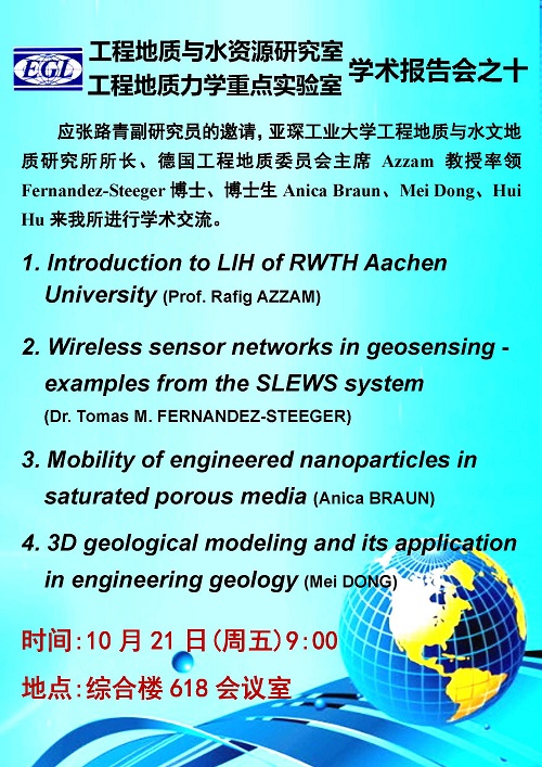
(1)Introduction to LIH of RWTH Aachen University
亚琛工业大学工程地质与水文地质研究所介绍(Prof. Azzam)
Abstract: Structure, personnel and recent researches of LIH of RWTH Aachen University are introduced.
(2)Wireless sensor networks in geosensing - examples from the SLEWS system用于地质监测的无线传感器网络-来自SLEWS系统实例(Dr. Fernandez-Steeger)
Abstract: A major demand in geotechnical or hazard monitoring is the fast and reliable data retrieval to evaluate the current situation of the monitored object. For this purpose a new type of environmental sensor network is necessary, providing on-line real time data retrieval. Resent research in the area of sensor network development in geosciences focus on the integration of micro sensors (MEMS) in ad hoc wireless sensor networks for real-time monitoring. An example of this type of modern environmental sensor networks is the SLEWS – Sensor based Landslide Early Warning System providing motion detection with position sensors as well as 3D acceleration, 2D inclination, barometric pressure and temperature data.
(3)Mobility of engineered nanoparticles in saturated porous media
饱和孔隙介质工程纳米粒子的流动性(PhD. student A. Braun)
Abstract: The growing production and application of engineered nanoparticles is raising concerns regarding their release into the environment. While it is believed that engineered nanoparticles are harmful for the human health still few is known about their fate in the environment and a possible exposure. In frame of the research project nanoFLOW at the Department of Engineering Geology and Hydrogeology at RWTH Aachen University the mobility of engineered nanoparticles in the groundwater is investigated. With the help of column experiments, triaxial experiments and batch experiments parameters relevant for the transport of nanoparticles in soils and rocks are determined and modelled.
(4)3D geological modeling and its application in engineering geology
三维地质模拟及其在工程地质中的应用(PhD. student M. Dong)
Abstract: 3D geological modeling has been demonstrated as a useful technique to represent the full extent of each geological unit and thus has been applied extensively to solve practical engineering problems. For this reason, a large and a small scale 3D geological models that play different roles in applications will be presented. The large scale model is constructed for visualizing the Post-Paleozoic formations of the city center (Aachen, Germany), by integrating 2D interpretive geological maps with numerous drilling data. In this case, the model is utilized to optimize the planning and development of land use in urban areas. The small scale model is built up for analyzing the slope stability in an open pit by using point cloud data derived from LiDAR scanning. The slope model will then be converted to adapted format for numerical simulation in 2D or 3D by the self-programmed tool.
亚琛工业大学工程地质与水文地质研究所主页
相关文献:
Paper 1:3D Modeling Using LiDAR Data and its Geological
Paper 2: Lecoanet_etal_2004
Paper 3:Monitoring of landslides and infrastrucutres with wireless sensor networks in an earthquake environment
Paper 4: Surface-Based 3D Modeling of Geological Structures
Paper 5:Wiesner_etal_2006

